
地理与地理信息科学理学学士
Bachelor of Science in Geographic Information Science


学历文凭
Bachelor Degree

专业院系
GIS技术

开学时间

课程时长

课程学费

国际学生入学条件
Hold a credential that is comparable to a U.S. high school diploma
Have a grade point average of at least 2.5 on a 4.0 scale. All marks and scores will be converted to a 4.0 grading scale.
Official high school (secondary school) exams, transcripts, or individual mark sheets sent from the school to International Admissions. If these documents are not in English, an official word for word English translation must be submitted with the original documents. IELTS - 6.0, TOEFL IBT - 73, PTE - 49
展开
IDP—雅思考试联合主办方
雅思考试总分
6.0
了解更多
- 雅思总分:6
- 托福网考总分:73
- 托福笔试总分:160
- 其他语言考试:PTE Academic score of at least 49
CRICOS代码:
申请截止日期:请 与IDP联系 以获取详细信息。
课程简介
配备最新GIS和制图软件的GIS实验室以及配备气象站的气象实验室,通过共享天气雷达在国家气象局数据中生成地图和分析的计算机系统<br>在GIS中心进行的有偿实习为顶尖学生提供了机会<br>教职员工拥有美国知名大学的博士学位。<br>小班授课意味着学生得到教职员工的一对一关注。在部门成员的指导下进行动手科学研究的机会
Geographic Information Science (GIS) is the study of spatial data and computer techniques used to capture, analyze, and display geographic information. Every undergraduate student is expected to acquire GIS skills in order to model scientifically the geospatial world and its components using GIS in a space-time framework. Our students are exposed to three perspectives of GIS learning: theoretical understanding, skill development, and real-world problem solving. Through hands-on training and practical applications, the students develop proficiency in using GIS techniques to address real-world problems, project design, implementation, and reporting. Our students may pursue an option in either Geospatial Science (Geographic Information Systems, Remote Sensing, and GPS) or Geoenvironment and Planning (physicalenvironment, human, urban planning, and regional planning).
Geographic Information Science (GIS) is the study of spatial data and computer techniques used to capture, analyze, and display geographic information. Every undergraduate student is expected to acquire GIS skills in order to model scientifically the geospatial world and its components using GIS in a space-time framework. Our students are exposed to three perspectives of GIS learning: theoretical understanding, skill development, and real-world problem solving. Through hands-on training and practical applications, the students develop proficiency in using GIS techniques to address real-world problems, project design, implementation, and reporting. Our students may pursue an option in either Geospatial Science (Geographic Information Systems, Remote Sensing, and GPS) or Geoenvironment and Planning (physicalenvironment, human, urban planning, and regional planning).
展开
相关申请

预科
奖学金
实习机会
在校学习

跨境学习
校园授课-线上开始
在线/远程学习

本校相关课程
会计学学士
学历文凭
Bachelor Degree
下一个开始日期
课程费用总额
Bachelor of Science in Agriculture
学历文凭
Bachelor Degree
下一个开始日期
课程费用总额
Bachelor of Arts in Political Science - American Government
学历文凭
Bachelor Degree
下一个开始日期
课程费用总额
双语/英语作为第二语言教育的教育学学士

学历文凭
Bachelor Degree
下一个开始日期
课程费用总额
生物化学理学学士

学历文凭
Bachelor Degree
下一个开始日期
课程费用总额
生物学理学学士
学历文凭
Bachelor Degree
下一个开始日期
课程费用总额
其他相关课程
空间分析硕士

多伦多都会大学
泰晤士高等教育世界大学排名:
学历文凭
Masters Degree
下一个开始日期
课程费用总额
地理信息系统研究生证书-地理空间管理
尼亚加拉学院
泰晤士高等教育世界大学排名:

学历文凭
Graduate Certificate
下一个开始日期
课程费用总额
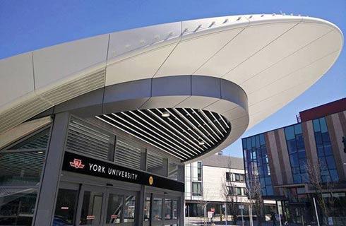
地理信息系统与遥感证书
约克大学
泰晤士高等教育世界大学排名:

学历文凭
Bachelor Degree
下一个开始日期
课程费用总额
荣誉地理信息系统科学学士学位-密西沙加
多伦多大学
泰晤士高等教育世界大学排名:

学历文凭
Bachelor Degree with Honours
下一个开始日期
课程费用总额
地理学(荣誉)文学士学位
卡尔顿大学
泰晤士高等教育世界大学排名:511

学历文凭
Bachelor Degree with Honours
下一个开始日期
课程费用总额
地理信息系统研究生证书-制图专家
弗莱明学院
泰晤士高等教育世界大学排名:

学历文凭
Graduate Certificate
下一个开始日期
课程费用总额