
Bachelor of Design / Bachelor of Science Conjoint - Geographic Information Science


学历文凭
Dual (Conjoint) Degree

专业院系
其他信息技术

开学时间

课程时长

课程学费

国际学生入学条件
International Baccalaureate Diploma with a minimum total score of 24.General Certificate of Education (GCE) Advanced Level. You must have completed a minimum of three A-Level subjects. Cambridge International Examinations (CIE). You must have completed a minimum of three A-level subjects.
展开
IDP—雅思考试联合主办方
雅思考试总分
6.0
了解更多
- 雅思总分:6
- 托福网考总分:80
- 托福笔试总分:160
- 其他语言考试:Pearson Test of English (PTE) - Overall score of 50 and no PTE Communicative score below 42
CRICOS代码:
申请截止日期:请 与IDP联系 以获取详细信息。
课程简介
The BDesBSc conjoint focuses on developing practical solutions for the future. We may not know the challenges and possibilities to be brought about by future technologies, but through scientific investigation, prototyping and testing, we can prepare to meet them head-on. Within the BSc side of the conjoint, you can follow your interests in earth, chemical, computational, human, life, mathematical or physical sciences. The BDes component will encourage inquiry and the testing of outcomes to create appropriate, sustainable solutions for products, services and innovation. The ability to respond to market trends and stay ahead of competitors sees companies investing heavily in design teams. The viability of solutions and innovations of the future will depend on data and scientific research. In-depth knowledge of scientific disciplines brings a level of authority and widens the potential impact on solutions in business, community, government and health.Study the data structures and techniques that are used to capture, process and visualise geographic information. If you’ve ever dropped a pin into Google maps, or found the shortest route using the public transport network, then you’ve engaged with Geographic Information Science (GIScience). New in 2019, this subject is the study of the data structures and techniques used to capture, process and visualise geographic information. It is estimated that 80% of data collected has some spatial component, whether it’s a city name, a street address or even a precise set of co-ordinates. We’ll teach you how to use data collected by satellites and drones, government-sourced data, and social media platforms to examine a wide range of social and natural processes.
展开
相关申请

预科
奖学金
实习机会
在校学习

跨境学习
校园授课-线上开始
在线/远程学习
学校排名
世界排名
201
数据源:泰晤士高等教育世界大学排名
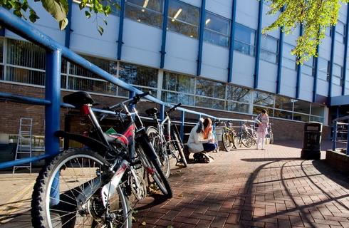
关于奥克兰大学

奥克兰大学(Waipapa Taumata Rau)位于世界上文化最多元化的城市之一,是新西兰唯一一所跻身世界百强的大学(2025 年 QS 世界大学排名)。该大学拥有七个校区,在校学生超过 40000 人,享有世界领先教育机构的美誉。学校每年接待来自 100 多个国家的 8000 多名留学生。该大学在帮助学生取得成功方面取得了卓越的成绩,其毕业生成果在新西兰排名第一(2025 年 QS 世界排名)就是最好的证明。2024 年,该校在《泰晤士报》全球高等教育影响力排名中保持第一(第 13 位),这是对该校在实现可持续发展目标方面所取得进展的认可。在 2024 年 QS 世界大学学科排名中,该校有 10 个学科进入前 50 名,为学生提供了无可争议的高质量学习体验。这些学科包括人类学、英语语言文学、教育学、土木工程和心理学。该大学拥有60多个研究中心和研究所,以为学生提供高水平教育为荣,使学生有能力为全球、社会、经济和文化的未来作出贡献和创造。学生还可以通过加入近200个不同的俱乐部和社团,使自己沉浸在大学社区中。
本校相关课程
语言教学深造文凭

学历文凭
Postgraduate Diploma
下一个开始日期
课程费用总额
健康科学研究生文凭-健康科学

学历文凭
Postgraduate Diploma
下一个开始日期
课程费用总额
美术学士(荣誉学位)

学历文凭
Bachelor Degree with Honours
下一个开始日期
课程费用总额
财产学士
学历文凭
Bachelor Degree
下一个开始日期
课程费用总额
护理学学士

学历文凭
Bachelor Degree
下一个开始日期
课程费用总额
法学学士(荣誉学位)

学历文凭
Bachelor Degree with Honours
下一个开始日期
课程费用总额
其他相关课程
MSc Cyber Security Technology [London]
诺森比亚大学预科学院
泰晤士高等教育世界大学排名:

学历文凭
Masters Degree (Taught)
下一个开始日期
课程费用总额
信息技术研究生文凭

奥塔哥理工学院
泰晤士高等教育世界大学排名:

学历文凭
(Graduate) Diploma level 7
下一个开始日期
课程费用总额
游戏开发学士

爱丁堡龙比亚大学
泰晤士高等教育世界大学排名:645

学历文凭
Bachelor Degree
下一个开始日期
课程费用总额
信息技术学士-CSU

学习集团(澳大利亚)
泰晤士高等教育世界大学排名:

学历文凭
Bachelor Degree
下一个开始日期
课程费用总额

信息技术学士
南澳大学
泰晤士高等教育世界大学排名:

学历文凭
Bachelor Degree
下一个开始日期
课程费用总额