
地理科学学士-地理信息系统和遥感
Bachelor of Science in Geography - Geographic Information Systems and Remote Sensing


学历文凭
Bachelor Degree

专业院系
GIS技术

开学时间

课程时长

课程学费

国际学生入学条件
200-400 word IU-specific essayAcademic records
展开
IDP—雅思考试联合主办方
雅思考试总分
6.5
了解更多
- 雅思总分:6.5
- 托福网考总分:79
- 托福笔试总分:550
- 其他语言考试:Pearson PTE- 53
CRICOS代码:
申请截止日期:请 与IDP联系 以获取详细信息。
课程简介
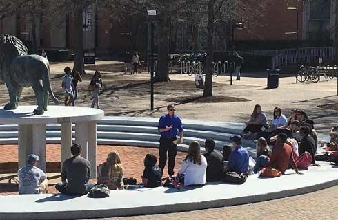
地理科学学士学位课程提供了额外的科学和定量要求,这些要求为面向科学的学生准备了学士学位级别的研究生院和与科学相关的工作。地理学学士学位提供了额外的科学和定量要求,这些要求使面向科学的学生为本科和学位课程的研究生院和与科学相关的工作做好准备。在快速的环境变化和全球化时代,气候变化等问题驱使我们了解如何更可持续地发挥作用,地理学是一个重要而有用的程度。地理课程是通识教育和科学教育的重要组成部分,但也提供环境科学,管理和相关领域的职业所需的技能和知识。<br>集中课程要求至少15个学时(包括至少12个学时)在3
Geographic Information System (GIS) and Remote Sensing (RS) are rapidly growing sub-fields with applications in environmental science, national security, demography, intelligence, forestry, disaster assessment, environmental management, climatology, urban planning, criminal justice, food studies, and agriculture among other areas. IU Geography is the principal location of training in Geographic Information Systems and Remote Sensing at Indiana University Bloomington. The curriculum includes the background, theory, and technical skills for global positioning system (GPS), digital mapping, image analyses (both satellite and airborne), geo-visualization, and spatial modeling in different fields. Our students in this concentration become GISRS professionals as environmental analysts, urban planners, university instructors, market analysts, cartographers, GIS librarians, disaster managers, and watershedforest researchers.
Geographic Information System (GIS) and Remote Sensing (RS) are rapidly growing sub-fields with applications in environmental science, national security, demography, intelligence, forestry, disaster assessment, environmental management, climatology, urban planning, criminal justice, food studies, and agriculture among other areas. IU Geography is the principal location of training in Geographic Information Systems and Remote Sensing at Indiana University Bloomington. The curriculum includes the background, theory, and technical skills for global positioning system (GPS), digital mapping, image analyses (both satellite and airborne), geo-visualization, and spatial modeling in different fields. Our students in this concentration become GISRS professionals as environmental analysts, urban planners, university instructors, market analysts, cartographers, GIS librarians, disaster managers, and watershedforest researchers.
展开
相关申请

预科
奖学金
实习机会
在校学习

跨境学习
校园授课-线上开始
在线/远程学习
学校排名
世界排名
134
数据源:泰晤士高等教育世界大学排名

本校相关课程
视觉科学哲学博士
学历文凭
Ph.D.
下一个开始日期
课程费用总额
听力学博士

学历文凭
Ph.D.
下一个开始日期
课程费用总额
语言与听力科学哲学博士

学历文凭
Ph.D.
下一个开始日期
课程费用总额
第二语言研究哲学博士

学历文凭
Ph.D.
下一个开始日期
课程费用总额
宗教学哲学博士

学历文凭
Ph.D.
下一个开始日期
课程费用总额
西班牙语言学哲学博士

学历文凭
Ph.D.
下一个开始日期
课程费用总额
其他相关课程
地理空间情报研究生证书

乔治梅森大学
泰晤士高等教育世界大学排名:426

学历文凭
Graduate Certificate
下一个开始日期
课程费用总额
土木工程学硕士-地理和地理信息系统
科罗拉多大学丹佛分校
泰晤士高等教育世界大学排名:

学历文凭
Masters Degree
下一个开始日期
课程费用总额
地理科学学士-地理信息系统
阿克伦大学
泰晤士高等教育世界大学排名:
学历文凭
Bachelor Degree
下一个开始日期
课程费用总额
Graduate Certificate in Geospatial Intelligence
乔治梅森大学-INTO USA
泰晤士高等教育世界大学排名:

学历文凭
Graduate Certificate
下一个开始日期
课程费用总额
Bachelor of Science in Geographic Information Science and Master of Science in GIScience and Geoenvironment
西伊利诺伊大学
泰晤士高等教育世界大学排名:

学历文凭
Combined Baccalaureate and Master's Prog
下一个开始日期
课程费用总额
Bachelor of Science in Geospatial Information Sciences
德克萨斯大学达拉斯分校
泰晤士高等教育世界大学排名:

学历文凭
Bachelor Degree
下一个开始日期
课程费用总额