
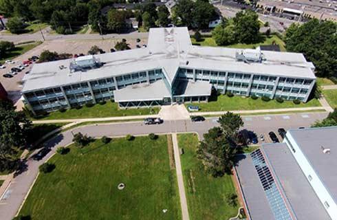
海洋测绘高级文凭
Graduate Certificate in Marine Geomatics

学历文凭
Graduate Certificate

专业院系
轮机工程与造船学

开学时间

课程时长

课程学费

国际学生入学条件
Diploma in a related technology program or undergraduate degree in science or engineering.
Copy of board-attested or direct-issued Certificate issued by All India – Central Board of Secondary Education (CBSE), All India – Council for the Indian School Certificate Examinations (CISCE), National Institute of Open Schooling (NIOS), or State Boards of Higher Secondary Education.
Copy of Statement of Marks/Mark Sheet for Grade 12. School-issued transcripts/records with marks are not acceptable.
Official transcripts – You must submit your official transcript(s) for courses required for admission.
International English Language Testing Systems (IELTS Academic Test) – minimum score of 6.0 on each test (Listening, Reading, Writing, Speaking).
Test of English as a Foreign Language (TOEFL) – minimum test scores of 80 on the Internet-Based Test (TOEFL® iBT), 60 on the Paper-Delivered Test, or 550 on the Paper-Based Test.
Canadian Test of English for Scholars and Trainees (CanTest) – average score of 4.5.
Canadian Language Benchmark (CLB) – minimum Level 8 on each test. Canadian Language Benchmarks Placement Test (CLBPT) is not accepted.
Canadian Academic English Language Assessment (CAEL) – minimum Band 60.
Michigan English Test (MET) – minimum score 59.
展开
IDP—雅思考试联合主办方
雅思考试总分
6.0
了解更多
- 雅思总分:6
- 托福网考总分:80
- 托福笔试总分:550
- 其他语言考试:Pearson Test of English Academic (PTE) – minimum test score of 55.
CRICOS代码:
申请截止日期:请 与IDP联系 以获取详细信息。
课程简介
该高级文凭课程旨在补充现有的自然科学大学学位,地理学文凭或以前的地理学相关经验。该计划为地理学以及有效的勘探,管理和监测海洋和沿海环境奠定了坚实的基础。在此领域中,您将综合大地测量技能应用到沿海测绘和航海制图,近海建设和资源勘探,沿海地区管理,栖息地测绘和环境科学中。您还将获得GPS定位和水文测量,地理信息系统(GIS),自然海洋学,遥感,制图学以及地理空间数据分析和表示所需的应用程序的技能,因为它们适用于海洋和沿海活动。作为海洋环境中的Geomatics专家,您可以帮助石油和天然气公司确定在何处以及如何
Process, analyze and interpret data captured in the terrestrial, marine and coastal environments.<br><br>In this graduate certificate program you:<br>Operate specialized acoustic mapping equipment, such multibeam echosounders and side-scan sonars, to acquire bathymetric data and detect anomalies on the seafloor<br>Install sensors on a survey vessel, configure devices and interface hardware with acquisition and navigation software<br>Manage a project from reconnaissance and planning to data acquisition and presentation of the final product<br>Set up and operate oceanographic equipment, such as tide gauges, current meters and speed of sound sensors<br>Collect three-dimensional data using the latest positioning technologies, such as Total Stations, Global Navigation Satellite System (GNSS), commonly known as global positioning systems or GPS, and LiDAR scanners<br>Present geospatial data by generating 3D digital models using the latest geographic information systems (GIS) and computer-aided drafting (CAD) software<br>This program is offered at the Centre of Geographic Sciences (COGS), Canada's largest geomatics-focused learning environment, and prepares you for a career in the global geomatics sector.<br>Career options<br>Travel the world and generally receive above average salary.<br>Work as an online surveyor, navigator/surveyor, data processor, data analyst, GIS analyst, CAD operator or land surveyor on geoscience and construction projects.<br>Be employed by federal hydrographic mapping agencies, ocean and seabed research organizations, environmental monitoring companies, offshore construction and engineering firms, land and construction survey companies and other private surveying and engineering firms and public sector organizations.<br>Graduates are involved in numerous activities related to coastal and offshore projects, including:<br>Performing bathymetric surveys and creating nautical charts<br>Assisting engineering companies determine the feasibility and routing of offshore cables and pipelines<br>Seabed investigations for, and installation of, offshore windmills<br>Navigating vessels for offshore construction activities, such as bridges and platforms<br>Assisting with the positioning of remotely operated vehicles, autonomous underwater vehicles and unmanned surface vehicles for seabed mapping and geophysical investigations<br>Providing survey services for mapping the coastal areas for erosion and environmental applications
Process, analyze and interpret data captured in the terrestrial, marine and coastal environments.<br><br>In this graduate certificate program you:<br>Operate specialized acoustic mapping equipment, such multibeam echosounders and side-scan sonars, to acquire bathymetric data and detect anomalies on the seafloor<br>Install sensors on a survey vessel, configure devices and interface hardware with acquisition and navigation software<br>Manage a project from reconnaissance and planning to data acquisition and presentation of the final product<br>Set up and operate oceanographic equipment, such as tide gauges, current meters and speed of sound sensors<br>Collect three-dimensional data using the latest positioning technologies, such as Total Stations, Global Navigation Satellite System (GNSS), commonly known as global positioning systems or GPS, and LiDAR scanners<br>Present geospatial data by generating 3D digital models using the latest geographic information systems (GIS) and computer-aided drafting (CAD) software<br>This program is offered at the Centre of Geographic Sciences (COGS), Canada's largest geomatics-focused learning environment, and prepares you for a career in the global geomatics sector.<br>Career options<br>Travel the world and generally receive above average salary.<br>Work as an online surveyor, navigator/surveyor, data processor, data analyst, GIS analyst, CAD operator or land surveyor on geoscience and construction projects.<br>Be employed by federal hydrographic mapping agencies, ocean and seabed research organizations, environmental monitoring companies, offshore construction and engineering firms, land and construction survey companies and other private surveying and engineering firms and public sector organizations.<br>Graduates are involved in numerous activities related to coastal and offshore projects, including:<br>Performing bathymetric surveys and creating nautical charts<br>Assisting engineering companies determine the feasibility and routing of offshore cables and pipelines<br>Seabed investigations for, and installation of, offshore windmills<br>Navigating vessels for offshore construction activities, such as bridges and platforms<br>Assisting with the positioning of remotely operated vehicles, autonomous underwater vehicles and unmanned surface vehicles for seabed mapping and geophysical investigations<br>Providing survey services for mapping the coastal areas for erosion and environmental applications
展开
相关申请

预科

奖学金
实习机会
在校学习
跨境学习
校园授课-线上开始
在线/远程学习
本校相关课程
学术和职业联系证书

学历文凭
Bachelor Degree
下一个开始日期
课程费用总额
成就证书

学历文凭
Bachelor Degree
下一个开始日期
课程费用总额
成瘾社区外展高级文凭

学历文凭
Graduate Certificate
下一个开始日期
课程费用总额
飞机维修工程师文凭(航空电子)

学历文凭
Bachelor Degree
下一个开始日期
课程费用总额
飞机维修工程师文凭(机械)

学历文凭
Bachelor Degree
下一个开始日期
课程费用总额
飞机维修工程师证书(结构)
学历文凭
Bachelor Degree
下一个开始日期
课程费用总额
其他相关课程
海洋与海军工程哲学博士

纽芬兰纪念大学
泰晤士高等教育世界大学排名:
学历文凭
Ph.D.
下一个开始日期
课程费用总额
海洋工程技术证书

西雅图中央社区学院
泰晤士高等教育世界大学排名:

学历文凭
Advanced Certificate
下一个开始日期
课程费用总额
Master of Science in Engineering (Thesis) - Naval Architecture and Marine Engineering
新奥尔良大学
泰晤士高等教育世界大学排名:

学历文凭
Masters Degree
下一个开始日期
课程费用总额
海洋甲板技术证书
西雅图中央社区学院
泰晤士高等教育世界大学排名:
学历文凭
Advanced Certificate
下一个开始日期
课程费用总额
海军建筑与海洋工程工程学硕士
不列颠哥伦比亚大学
泰晤士高等教育世界大学排名:

学历文凭
Masters Degree
下一个开始日期
课程费用总额
Master of Science in Engineering (Non-Thesis) - Naval Architecture and Marine Engineering
新奥尔良大学
泰晤士高等教育世界大学排名:

学历文凭
Masters Degree
下一个开始日期
课程费用总额